With September’s cooler temperatures and new month transition to Fall, fire activity began to moderate across much of the West. But, California and the more western geographic areas, did continue to burn. As a result, the national preparedness level (PL) remained at five through September 20, spanning 69 days. This was the longest period on record. Additionally, the national PL remained at four for another 8 days, for a record of 99 days at PL four or five. Despite the busy summer, total acres burned in 2021 to date remains below the 10-year average.
With nearly 90% of the West still in drought it was fortunate that some areas did experience above average precipitation. Much of the Pacific Northwest and into the northern Idaho Panhandle, and northwest and northeast portions of California saw an uptick of rain in September. Slight improvement of drought conditions was also noted in portions of the Desert Southwest, Utah, Wyoming, Montana. But, not helping the drought, most of California, Great Basin, and Rocky Mountains had below average precipitation.
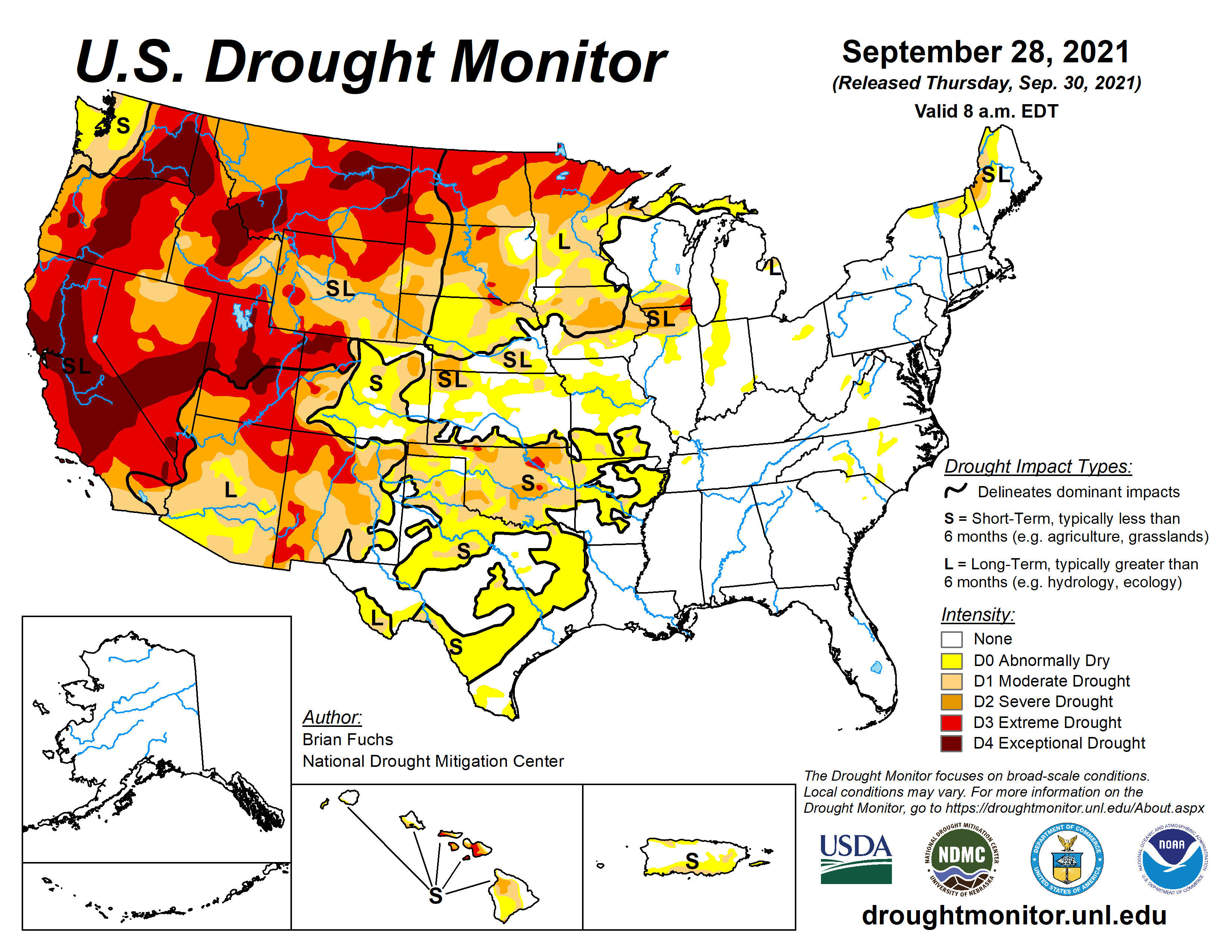
Current Drought Conditions across the US as of September 28th, 2021
New Month, So What’s the Outlook?
Long term outlooks indicate that much of the country will experience warmer than normal conditions in the coming months. Exceptions include the Pacific Northwest, Northern Rockies, and the western Great Lakes where above normal precipitation is also likely. Most areas of the US are likely to have near normal significant fire potential or are out of fire season through January.
But, continued below normal precipitation and drought is likely for the southern half of the West and the southern and central Plains. Portions of OK and TX, MT, ND, Northern CA, and HI will all have elevated wildfire potential. As winter sets in, below normal precipitation in the Southeast this fall could lead to elevated fire danger by January.
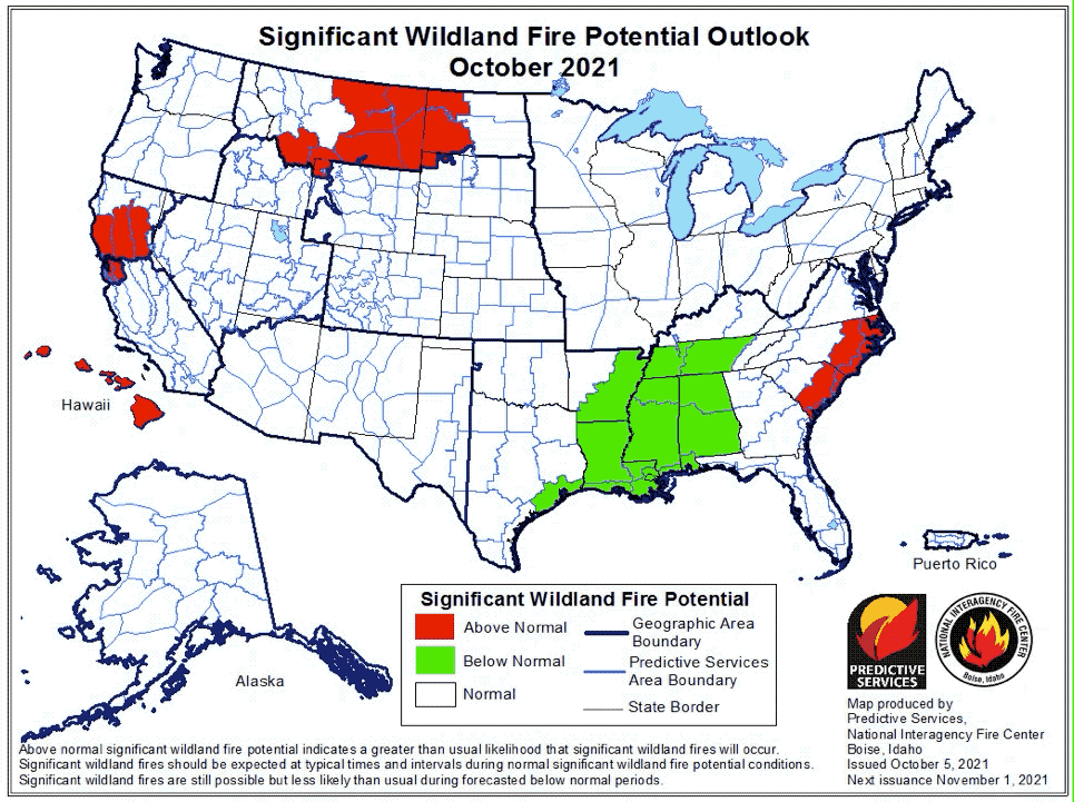
Wildfire Potential the next three months (Oct21-Dec21)
Back to Back La Niñas?
New month, but similar story to 2020’s winter. Similar to last year, near-to-below average sea surface temperatures (SSTs) are present over much of the equatorial Pacific Ocean. As a result, the Climate Prediction Center (CPC) forecasts a 70-80% chance of La Niña developing again in the next few months. Back to back La Nina winters are likely have a major impact on 2022’s climate and both Fire and Hurricane Seasons.