
Well, here we are again. Northern California is bracing for gusty North Winds and dry air overnight and through tomorrow midday. The gusty offshore flow, which originates in the Great Basin when a High or Low pressure system sets up over the region. The weather anomaly isn’t much of an anomaly as North Winds blow from the Great Basin have been a perennial wildfire culprit in both Northern and Southern California. As a result a Red Flag Warning has been issued for much of Northern California this week.
From the National Weather Service:
An early season low pressure trough is forecast to descend into Great Basin through midweek. This will place much of California in the lee portion of the trough. A period of dry, gusty offshore flow will follow across the interior North and East Bay hills and mountains. Expect gusty north to northeast winds across the interior peaking late Tuesday (8/17) into early Wednesday (8/18). And again more locally Wednesday night (8/18) into early Thursday (8/19). Poor overnight recoveries and extremely low daytime humidity values in the teens each afternoon.
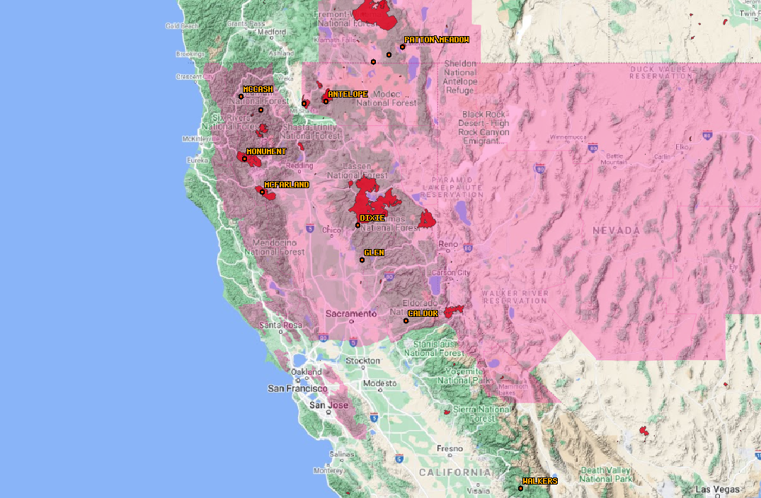
The NWS issued a Red Flag Warning across much of Northern California for gusty offshore winds (8/17-8/18, 2021)
The warning is in place not only for areas in danger of new starts but also for the large fires already raging in the region. Large fires, like the now 600,000-acre Dixie, could see a large increase in activity this week as a result. The Western US has been at Preparedness Level 5 meaning resources for any new fires will be harder to come by. Fuel moisture and drought conditions in the region are at dangerously low levels. The recipe is there for a long week, month, and rest of 2021 fire season.
One Comment