Tropical Storm Fred is the sixth named storm of the 2021 Atlantic Hurricane Season. It was tracking just south of Puerto Rico and is likely to impact the Southeast US beginning this weekend. The storm has caused flooding and power outages throughout Puerto Rico and the Dominican Republic.
Current Forecast
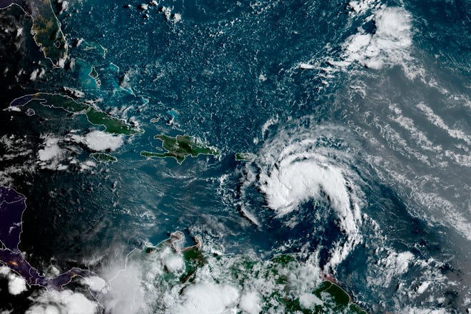
The center of Tropical Storm Fred was moving just south of the eastern Dominican Republic this morning. The storm had maximum sustained winds of 45 mph, moving west-northwest at a speed of 16 mph. Fred was located about 25 miles south-southeast of Santo Domingo, Dominican Republic’s capital.
The storm will likely cause power outages, dangerous surf, and heavy rainfall leading to possible flash flooding. Tropical storm warnings have been discontinued for the US Virgin Islands and Puerto Rico, however remain in place for most of the Dominican Republic’s coastline. See below for a list of current watches and warnings.
Tropical Storm Warning:
- The Dominican Republic on the south coast from Punta Palenque eastward and on the north coast from the Dominican Republic/Haiti border eastward
A Tropical Storm Watch:
- Haiti from the northern border with the Dominican Republic to Gonaives
- Turks and Caicos Islands
- Southeastern Bahamas
- The Cuban provinces of Ciego de Avila, Camaguey, Las Tunas, Holguin, Granma, Santiago de Cuba, and Guantanamo
Next, the system is forecast to continue on a general west-northwest path near or over some of the islands in the north-central and northwestern Caribbean into Friday. Then, it will take a turn toward the northwest and north, bringing the storm northward toward the US this weekend. Fred is not currently expected to strengthen into a hurricane, as it weakens over the islands. However, the forecast is likely to shift as the storm progresses.

Potential US Impacts
The storm will likely impact the Southeast US beginning as early as Friday. Depending on its exact track and strength, the storm could cause flooding, heavy rainfall, and rough surf along the Florida Keys and western peninsula coast. Additionally, there is an increasing risk of wind in the region as well through Monday.
Unfortunately, it is too early to tell which areas may see the most impact. A track right over the Florida Peninsula might bring torrential rain and flooding problems, as well as, locally damaging winds from thunderstorms. Contrary, a distant track over the eastern Gulf might bring less rain and wind to the peninsula. However, this would allow the storm to strengthen as it spins over warm waters, adding concerns for the upper Gulf coast of Florida and southeastern US mainland early next week.
Source: National Hurricane Center, Accuweather