RedZone Senior Wildfire Liaison Doug Lannon attended The Thomas Fire Retrospective Report discussion was held at 5:30 pm on Wednesday, October 17th, 2018 at the Montecito Fire Protection District (FPD) Headquarters located at 595 San Ysidro Road in the community of Montecito, California. These are some key points that Doug took away from the discussion.
The presentation was sponsored by the Montecito FPD Board of Directors and Montecito Fire Chief Chip Hickman. The discussion was led and facilitated by Dr. Crystal Kolden, Director of the Pyrogeography Lab and Associate Professor of Fire Science for the University of Idaho, College of Natural Resources. Dr. Kolden presented the history of the community of Montecito’s Wildland Fire Program Policy, and actions from when it was first discussed after the devastating Painted Cave Fire which occurred in 1990 near Goleta, and was then instituted after the even more destructive Tunnel Fire which occurred in 1991 in the Oakland Hills. The program has been enthusiastically supported and continued to date by the Montecito FPD Board of Directors, the Montecito FPD personnel, and the Citizens of Montecito, due to a highly effective and efficient Community Fire Protection and Fire Prevention Education and Partnership Program. Dr. Kolden also discussed the types of mitigation strategies that have been successful in recent wildfires, both for individual homeowners and for communities.
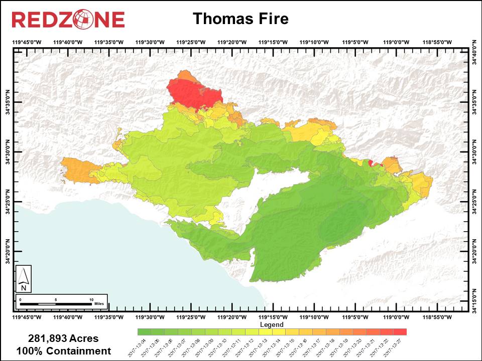
The map above shows the new acreage that was burned at the end of each day.
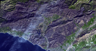
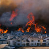
Montecito was just one of several cities and communities that were threatened and received significant impact to residential and commercial properties during the 2017 Thomas Fire. However, compared to other communities impacted by the Thomas Fire, the community of Montecito suffered only a fraction of the damage that other communities suffered during the Thomas Fire. Montecito’s wildland fire program has spent the last 20 years developing a set of systems to combat the threat of wildfire. These systems include implementing new stringent building codes and architectural guidelines, creating a hazardous fuel treatment network across the northern portion of the community, developing a pre-attack plan to disseminate critical fire ground information to mutual aid resources, developing partnerships within the community and with adjacent agencies, and building a community education program that facilitates a positive working relationship with the community. These systems were successfully deployed to support structure defense actions by the more than 500 firefighters assigned to Montecito the morning of December 16th, 2017. The Community Education and Partnership Program include: defensible space surveys and inspections, neighborhood chipping days, preparedness planning, pre-attack zones and homes, voluntary and mandatory evacuation zones and trigger points, widening roads, hardening structures, and ornamental shrubbery around structures, etc. In part, due to the effectiveness of the systems, only minimal structure loss and damage occurred, but most importantly, no lives were lost or serious injuries occurred prior to and during the fire fight. A post-fire assessment found that the seven primary residences destroyed during the Thomas Fire lacked defensible space, lacked safe access due to narrow roads or no turnarounds for fire apparatus, were constructed of flammable construction materials, or were situated where gaps existed in the fuel treatment network. Forty other properties received varying degrees of damage to outbuildings, fencing, ornamental shrubbery, etc.
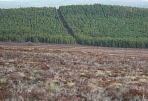
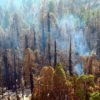
Depicted in the image above is a well defined fuel break similar to the examples mentioned in this blog topics.
In retrospect, the Thomas Fire demonstrated how proactive actions implemented by the District and the community in the past 20 years contributed to the successful defense of the community during the Thomas Fire. Post-fire, Montecito still has unburned fuel in smaller enclaves within the community and within the 2008 Tea Fire and 2009 Jesusita Fire burn scars. These open space areas still have the potential to support smaller, more localized wildfires. Given the favorable climatic conditions of the Central Coast, over the next 10-20 years, vegetation in the footprint of the Thomas Fire will be able to support wildfire again. There is much opportunity for the District to use the Thomas Fire burned area to continue to expand and improve upon the existing fuel treatment network. Treating vegetation as it regrows will be less labor intensive and less costly than in the past. Leveraging community partnerships, improving the use of technology to support fire operations, modifying defensible space fire codes, and continuing the wildland fire safety and education of the community are critical steps for the District in the upcoming years as they prepare for the inevitable next wildfire. We know it’s coming, it’s just a matter of when!
(Excerpts for this story were taken from the Thomas Fire Retrospective Report produced by GEO Elements, LLC.)

3 Comments