
The world’s oceans, vast and mysterious, hold crucial clues to one of nature’s most formidable forces: hurricanes. Recent studies have underscored the intricate relationship between ocean temperatures and the intensity of these tropical storms, shedding light on how we can better forecast and prepare for their impact.
At the heart of this relationship lies the principle of energy transfer. Hurricanes draw their strength from warm ocean waters, acting as fuel for their development and intensification. As temperatures rise, so does the potential for stronger and more frequent storms. This correlation has been a focal point for scientists and meteorologists striving to enhance our understanding of hurricane behavior.
Our Warming Oceans
Research indicates that as ocean temperatures continue to climb due to climate change, the likelihood of more powerful hurricanes becomes increasingly probable. Warmer waters not only provide the initial energy boost for storms but also sustain their intensity over longer distances, posing greater risks to coastal communities and ecosystems.
Furthermore, advancements in technology and data analysis have allowed forecasters to refine their predictions by closely monitoring ocean temperature patterns. By tracking temperature anomalies and ocean currents, forecast models can better anticipate the development and trajectory of hurricanes, offering vital insights for disaster preparedness and response efforts.
In a critical region of the Atlantic Ocean where hurricanes originate, temperatures are currently notably elevated, as shown in the map below. This warming trend, coupled with the likelihood of ENSO Neutral or La Nina conditions, instills growing confidence among meteorological forecasters regarding the likelihood of an unusually active hurricane season ahead.
Probably the most touted of these forecasters, Phil Klotzbach, a researcher affiliated with Colorado State University, unveiled his team’s latest projections, indicating an exceptionally active season anticipated to unfold. Their forecast predicts a total of 23 named storms, with 11 potentially intensifying into hurricanes, and among them, five could escalate to major hurricane status, defined as Category 3 or higher. By contrast, historical averages typically depict a season featuring 14 named storms, seven hurricanes, and three major hurricanes. According to Klotzbach its the highest April prediction ever for his team.
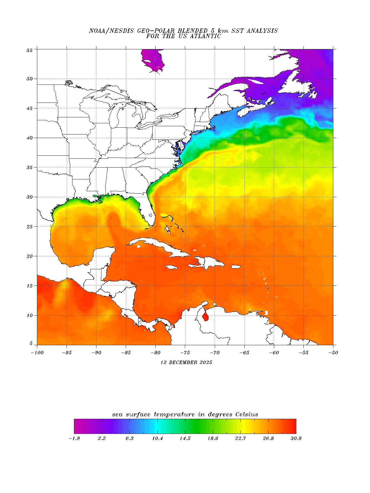
Current as of April 14, 2024 Sea Surface Temperatures for the Atlantic Ocean.
Ocean Temperatures Not the Only Factor
However, while ocean temperatures serve as a fundamental indicator for hurricane activity, other factors, such as atmospheric conditions and wind shear, also play significant roles in shaping storm behavior. If La Nina conditions do transpire, they typically lessen the vertical wind shear in the Caribbean Sea which generally helps keep tropical storms from staying formed and/or intensifying. Though early, it appears the complex interplay of these variables have forecasters in agreement that 2024 will be ripe hurricane conditions in the Atlantic.