With the duties assigned to fire agencies becoming more daunting as the population continues to grow, and climatic conditions favor worse fire behavior, the service has adopted GIS as a means to combat these ever changing factors. In this blog, I briefly touch on some of the aspect that GIS software programs have been implemented in the fire service to help mitigate some of the issues related to the disasters they face on a daily basis.
Response
One of the multiple facets that GIS was incorporated into was the fine tuning of response times for fire resources. The ArcGIS software suite has created a Network Analyst extension specifically for solving this geospatial problem. The end result of utilizing the tools within this extension would be a map with a visual buffer that represented the time it would take a fire engine to reach that point. The parameters could be set for the response areas to paint a more accurate picture of which fire engine should be responding to an emergency in a specific location.
The industry has shifted from this particular tool set and has branched out into a more proprietary software market. This allows departments to hire companies/contractors to create specific tool sets to fit the department’s needs.
Risk
GIS has helped fire personnel assess risk in a variety of ways, from large to small scale. GIS has been used to create models that essentially forecast the probability of a large fire occurring in a certain geographic area. This can help preposition resources in preparation for when these incidents occur.
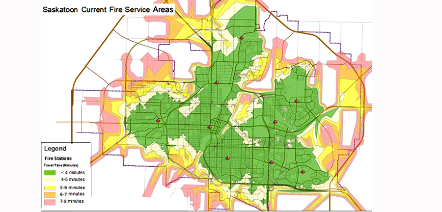
This is a typical output from network analyst that displays average response times within the city of Saskatoon.
Planning
Pre-fire plans are utilized on both a city wide scale, all the way down to individual industrial and large buildings. These plans are step by step actions that are to be followed during wildfire or structure fire. In the case of a commercial structure fire, these plans depict critical infrastructure that is pertinent to fire ground operations. In regards to a city wide pre-fire plan, GIS can be implemented to optimize the efficiency of evacuations to assisting in identify strategic natural barriers or fuel breaks to base a suppression plan off.
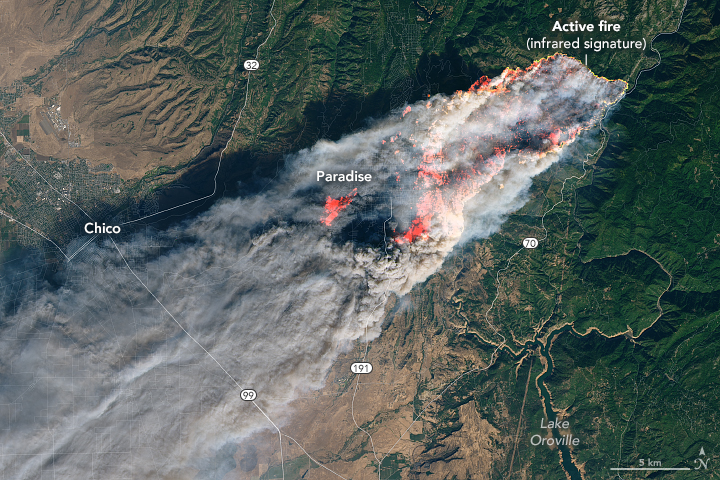
Wildfire Modeling
GIS models have been created that incorporate some of the major predictors of fire spread. Incident management teams are using these models on a daily basis to assist in making informed decisions in regards to combating these growing fires.
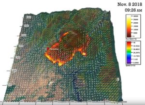
This is an image of a model that was run during the Camp fire. Incident commanders can use this information to formulate a plan for suppression operations.
These geospatial tools and solutions I have mentioned above, only scratch the surface in which GIS has been implemented in the Fire service and disaster response industry. As these disasters continue to becoming more challenging for our professionals to deal with, GIS will always be another tool in the toolbox for them.