
NOAA predicts yet another above-normal Atlantic Hurricane season. Climate change and La Niña will drive an increase in storms. This hurricane season will piggy pack on the past two extremely active hurricane seasons.
2022 Atlantic Hurricane Season Outlook
Each year, NOAA generates a list of Tropical Cyclone Names to be assigned in the event of a storm. 2021 was the first time in recorded history that we have had two consecutive hurricane seasons exhaust the list of all 21 storm names. Also, this marked the third most active hurricane season, with 2020 being the most active hurricane season in history.
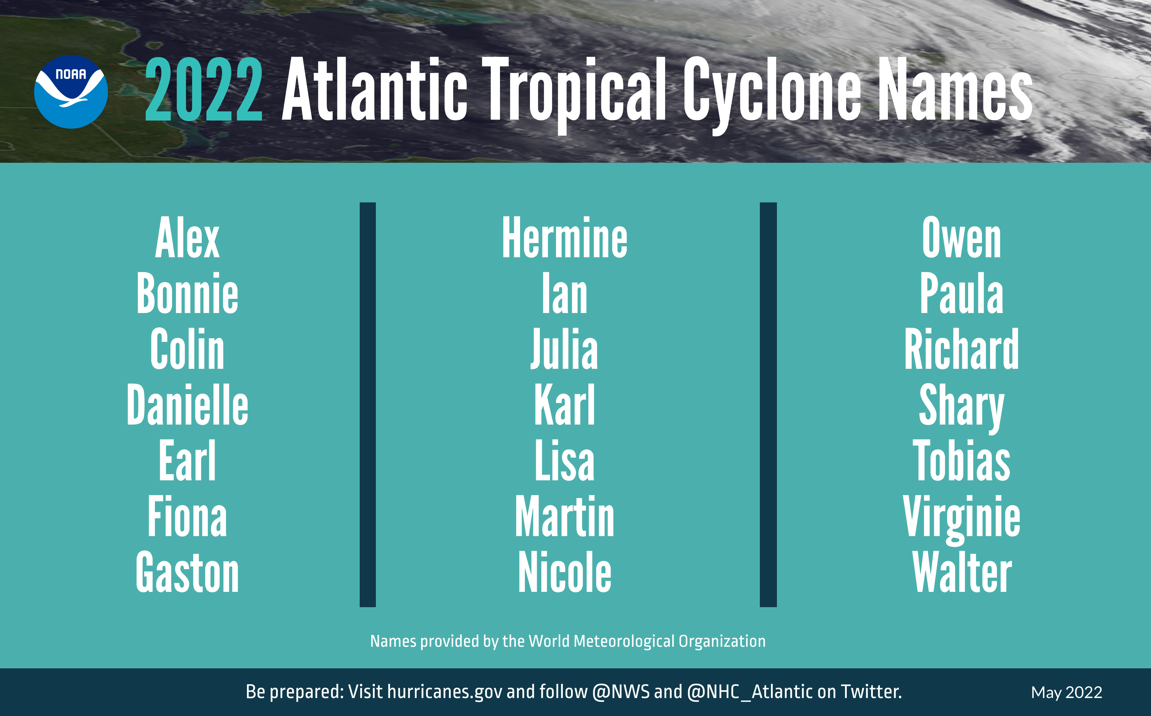
NOAA’s 2022 Atlantic Tropical Cyclone Names
Due to several factors including the ongoing La Niña, increasingly warm sea surface temperatures, weaker tropical Atlantic trade winds, and an enhanced west African monsoon, this hurricane season is expected to challenge last years.
The 2022 Atlantic Hurricane Season Outlook predicts a 70% chance of each of the following ranges of activity:
- 14-21 named storms with top winds of 39 mph or higher
- Increased from 13-20 in 2021
- 6-10 hurricanes (top winds 74 mph or greater)
- Unchanged from 2021
- 3-6 major hurricanes, including category 3-5 (top winds 111 mph or higher)
- Increased from 3-5 in 2021
- Accumulated Cyclone Energy (ACE) range of 180% of the median
- Higher than the average of 123%
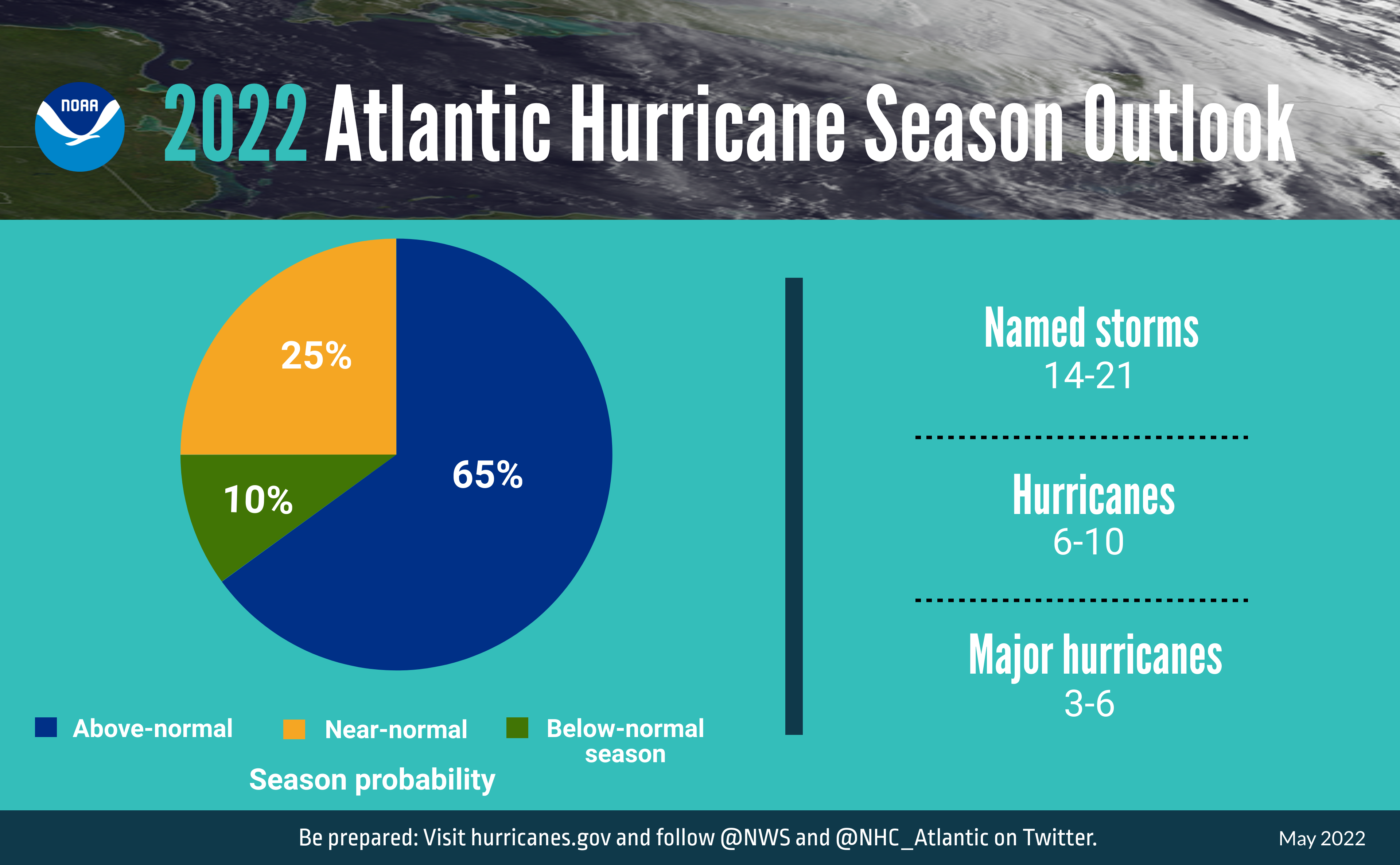
NOAA’s 2022 Atlantic Hurricane Season Outlook
Additionally, NOAA predicts a 60% chance that activity in the Central Pacific in 2022 will be below-normal with 2-4 (normal being 4-5) tropical cyclones.
Research Improvements
Improvements in technology and research since 2005 have enabled NOAA to significantly decrease the Cone of Uncertainty and increase predictions of hurricane intensity. NOAA’s 2022 enhancements include:
- Growing their fleet of satellites and Saildrone vehicles
- Increasing operational supercomputer capacity
- Improving an experimental graphic that depicts the Peak Storm Surge Forecast
- Extending Excessive Rainfall Outlook (ERO) from 3 to 5 days of lead time
- Transitioning models to the newest version of the Weather and Climate Operational Supercomputing System
One Comment