
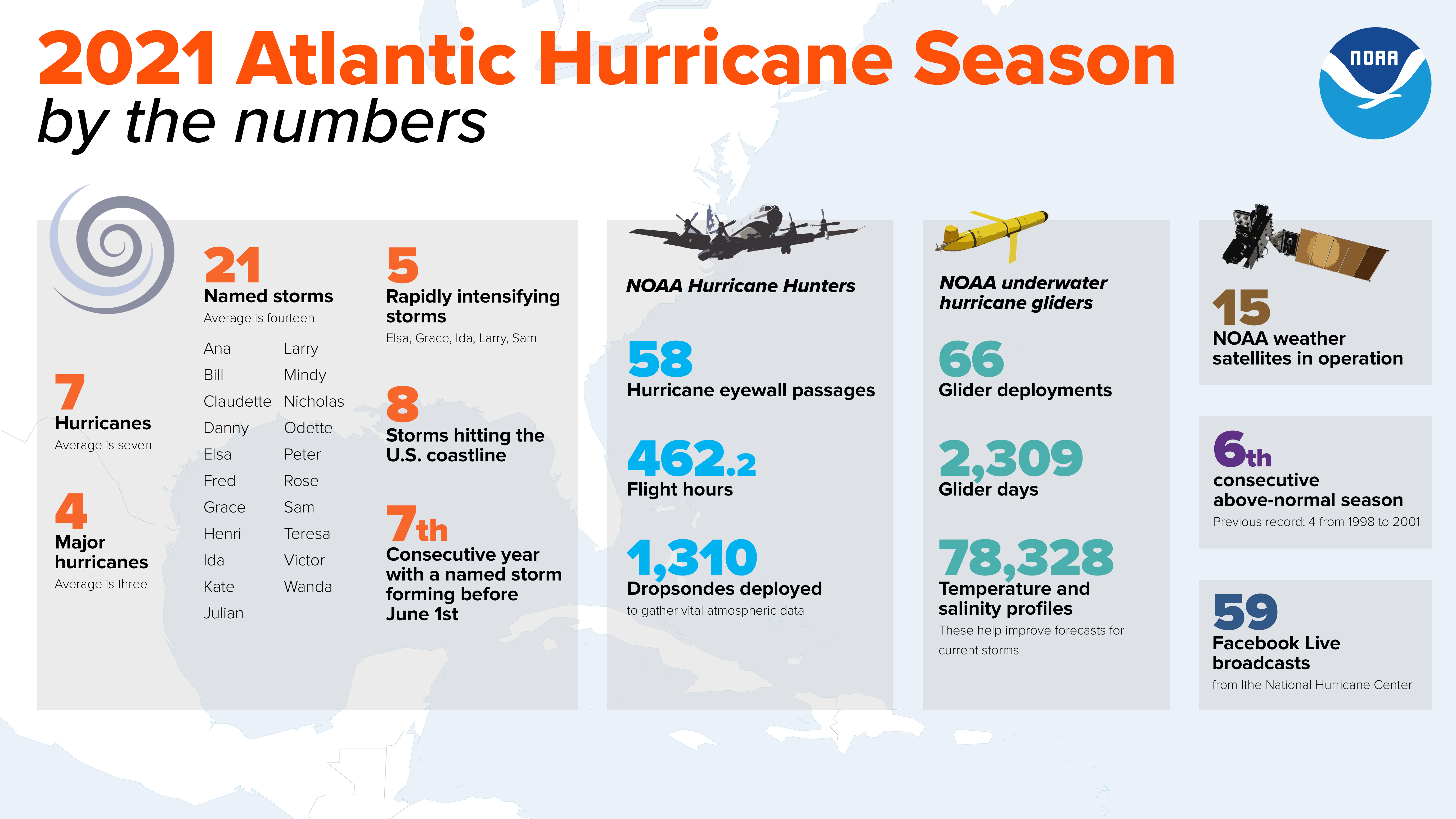
November 30th officially marked the end of the 2021 Atlantic Hurricane Season. The National Oceanic and Atmospheric Administration (NOAA) accurately predicted an above-average season with 21 named storms. Subsequently, this year marks the sixth successive above-average season in a row. Additionally, it is the second season in a row to exhaust the list of storm names.
Recap
The season began early and intensified quickly. It is the seventh consecutive year where a storm developed before the official June 1st season start date. Tropical Storm Ana emerged just ten days before on May 22nd. The season totaled 7 hurricanes and 4 major hurricanes (Category 3 or higher). The strongest two storms were Ida and Sam at Category 4 strength. Grace and Larry peaked as Category 3 storms.
NOAA’s 2021 Atlantic Hurricane Season by the Numbers
New Technology
NOAA scientists successfully deployed five new extreme weather Saildrones to collect data throughout this year’s hurricane season. The first-ever video and measurements were captured at the surface of the ocean during a major hurricane. The technology handled 125 mph winds and 50-foot waves during Hurricane Sam. This data from Saildrones, ocean gliders, and aircraft-released sensors is helping NOAA to better represent forecast hurricane conditions.

NOAA’s Sailordrone Capturing Footage during Hurricane Sam
Next Year’s Forecast
NOAA’s Climate Prediction Center will issue its initial seasonal outlook in May. Current climate trends suggest yet another active year.
One Comment