Hurricane Florence Current Situation
As of: 2100 UTC, Sep 13nd, 2018
- Location: 100 miles ESE of Wilmington, NC
- Size: Category 2
- Maximum Sustained Winds: 100 mph
- Present Movement: WNW at 5 mph
- Minimum Central Pressure: 955 mb
- Impact: Up to 11 feet of storm surge, heavy rain causing flash flooding
- Incident Page: NHC Public Advisory
- News Article: WunderBlog
Hurricane Florence Outlook
Hurricane Florence has started to impact North Carolina’s barrier islands. As it reaches landfall, the storm has been downgraded to a Category 2 Hurricane, but don’t let the category number fool you. Florence remains a massive and devastating hurricane. The storm continues to grow in area and is predicted to impact a large portion of the North and South Carolina coasts. Maximum sustained winds are hovering around 100 mph, with some higher gusts. Hurricane force winds extend up to 80 miles from the eye of the storm. Some coastal areas are already seeing storm surge flooding. At the peak of the event, areas around river outflows could be dealing with storm surges up to 11 feet. The greatest storm surge inundation is expected between Cape Fear and Cape Hatteras where river outflow will meet the storm surge inundation. Inland areas are not necessarily in the clear from the damage. Significant flash flooding and prolonged river flooding could extend as far as the Appalachians through early next week as the storm moves inland.
Nearly 2 million people are under hurricane Warning. Authorities are cautioning residents in evacuation zones to get out because first responders will not be able to perform rescues during the storm. Power outages are already affecting around 100,000 people and are expected to get worse as this incident continues.
Click here to look back on this year’s hurricane season outlook to see how the predictions are panning out.
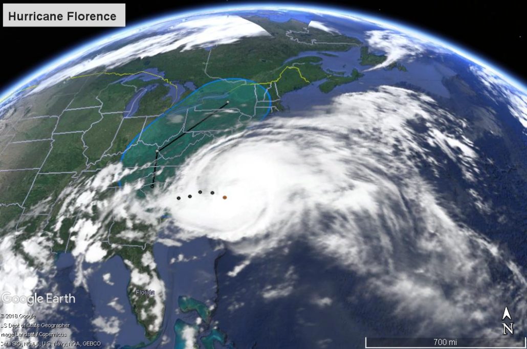
View of the storm path and cone of uncertainty.
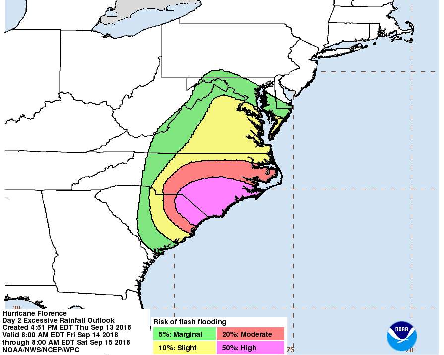
Predicted Flash Flooding Risk