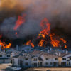
The Tinder fire was ignited Friday April 30th in the Blue Ridge area about 50 miles southeast of Flagstaff. RedZone began actively monitoring that afternoon as it grew to 50 acres. By Saturday night the fire slowly grew to 230 and then 500 acres only. On Sunday, things changed drastically. Fanned by strong southwest winds, the Tinder fire made an 8,000 acre run to the Northeast. The run pushed the fire into and beyond the community along Hwy 87 threatening homes in the Moquis Ranchettes, Starlight Pines, Clear Creek, Timber Ranch, Tamarron, Pine Canyon, Blue Ridge Estates, Ponderosa Pines and Mogollon Ranches areas.
Tinder Fire Slows its Growth
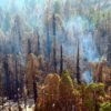
Monday, the fire has grew to over 11,000 acres with most of the growth, luckily, on the right or eastern flank where there are no homes or neighborhoods. Fortunately, despite strong winds continuing in the area, only 300 acres of growth was seen yesterday. In addition, the fire area experienced precipitation of snow and light rain overnight that should assist firefighters’ progress (from only 7% as of 5/2/18) with containment lines. Furthermore, with an estimated 30 homes impacted, damage assessments were completed Monday by the IMT. But, as of today, there were still no results released to the public. As a result of the fire situation, road, area and trail closures are in effect.
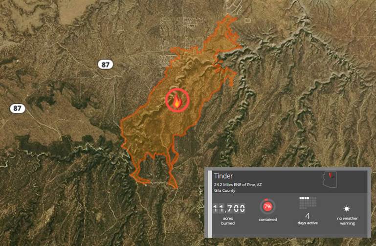
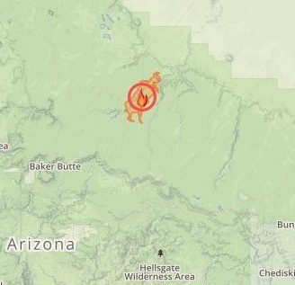
The Tinder Fire Perimeter as of May 2nd, 2018
Tinder Fire Facts: (As of May 2, 2018)
- Location: Blue Ridge Reservoir, 48mi SE of Flagstaff, AZ
- Cause: Investigators have confirmed that the cause of the blaze was an abandoned illegal campfire.
- Size: 11,736 acres
- Containment: 7%
- Fire Behavior: Moderate fire spread through timber and chaparral.
- Structures Threatened: _1,700_ PRIM; __COMM; __OUTB
- Structures Destroyed: _UNK_ PRIM; __COMM; __OUTB
Additional Tinder Fire Info:
For further info, please visit: