As wildfire risk regulations continue to evolve, we’re keeping a close eye on new legislation that could impact how wildfire exposure is assessed across the country. One of the most recent developments is out of Utah, and we’ve outlined some key takeaways below; including how we’re adapting RZRisk3 to stay ahead of the curve.
The Bill
The bill requires state officials to create a wildfire risk assessment mapping tool. This tool will help identify high-risk properties across Utah’s Wildland Urban Interface (WUI). Properties will be evaluated and classified by wildfire coordinators using a new triage system. But, with the legislation comes implications for those who are classified with the worst risk. Counties must perform annual assessments on these high-risk areas. If a property falls into the highest risk category, the owner will be charged an annual mitigation fee. The money will go to a new fund supporting fire prevention and preparedness programs. Counties may also keep part of the fees to cover administrative costs.

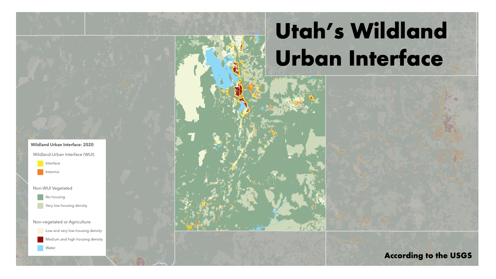
Utah’s Wildland Urban Interface (WUI) area was updated in 2020 by the USGS. But, this federally generated map of the areas as not commonly accepted by state and local governments who prefer to do their own mapping. [Data provided by USGS]
Stricter Insurance Rules and Building Codes
Insurers must now use Utah’s wildfire risk mapping tool when setting rates or deciding coverage. They also need to explain cancellations, non-renewals, or premium increases above 20%. The Department of Insurance can require third-party reviews of insurer rate filings tied to wildfire risk. In addition, counties and cities must adopt the Utah Wildland Urban Interface Code. This includes stricter building and safety standards for homes in wildfire-prone areas. If a county refuses to comply, the state may limit its fire cost coverage.
Utah’s new law shows a growing commitment to managing wildfire risk. In addition, the combination of mapping, funding, insurance regulation, and building codes offers a proactive path forward. Consequently, its a path that other states could mimic.
Implications for our Products
- How WUI is defined – While Utah is the first state to sign this bill into law, other states are likely to follow. Each State Department of Insurance mandate is expected to vary on WUI definition, regulations and implications
- RedZone action – For states that specify a definition and digital maps, RedZone will incorporate this info in our RISK3+ API
- What’s already available? – The USGS provides a National WUI map (see above), but initial indications suggest that State Departments of Insurance have little interest in adopting it


