Category 3 Hurricane Douglas is looking very likely for a weekend arrival in Hawaii. Interestingly, the storm could make landfall, at hurricane strength, over the Big Island or Oahu for the first time since 1992. Most storms weaken before actually reaching the islands. Even if it is another near miss or weakens to tropical storm force, there is a high chance that strong winds, dangerous surf, and heavy rainfall will affect portions of the state beginning late Saturday.
Rare for Hurricanes to Make landfall on the Islands
As we mentioned previously with Hurricane Lane , Hawaii is normally protected from approaching hurricanes because of cooler waters around the islands. An additional buffer is provided by a high pressure system that sits over the state during the majority of the hurricane season. Only two hurricanes have made landfall in Hawaii since the 1950s. Hurricane Dot (1959) & Hurricane Iniki (1992). Hurricane Douglas is forecast to reach the islands as a Category 1 but may yet weaken below the Hurricane threshold.
Hurricane Douglas Current Conditions
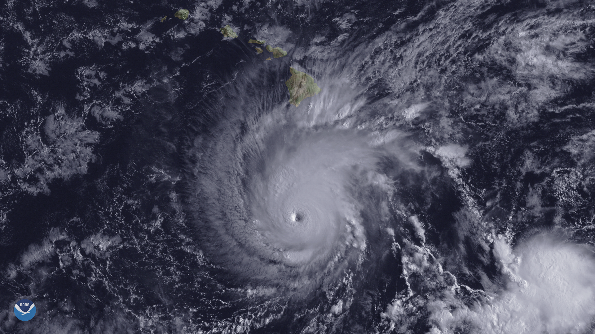
Douglas remains a powerful Category 3 hurricane early this morning, although the satellite presentation has degraded a bit as the storm has begun to track over the slightly cooler sea surface temperatures forecast to weaken it. The steady weakening is expected to continue the next couple days as Douglas approaches Hawaii. As a result, the cyclone should be a weaker category 1 hurricane or strong tropical storm when it reaches the eastern end of the state late Saturday night or Sunday.
Based on the latest intensity and track forecasts, Hurricane or Tropical Storm warnings may be required for portions of the eastern end of the state (Big Island and the Maui County Islands) by this weekend. Watches for both islands have already been issued and so far include:
A Hurricane Watch is in effect for…
* Hawaii County
* Maui County, including Maui, Lanai, Molokai and Kahoolawe

Coastal Watches/Warnings and Forecast Cone for Hurricane Douglas (as of Friday Evening July24)
Storm Facts:
- As of – July 24th 2020. 1100 HST
- Location: 725 Miles ESE of Hilo, HI
- Max sustained wind: 115 mph
- Movement: WNW at 18 mph
- Storm Behavior: Douglas tracking WNW as a Category 3 Hurricane
Sources:
National Hurricane Center
Wikipedia