This year Hawaii has already experienced lava flows and earthquakes from the Kilauea eruption, now the state braces for high winds, flooding, mudslides, brushfires and even the possibility of tornadoes caused by the approaching Hurricane Lane. Hurricane Lane became a named storm on Wednesday August 15th off the southwestern coast of Mexico. The storm gradually strengthened, becoming a hurricane by that following Friday. As the hurricane churned its way slowly westward, early forecasts were already predicting the storms turn towards the Hawaiian Islands.
Rare for Hurricanes to Make landfall on the Islands
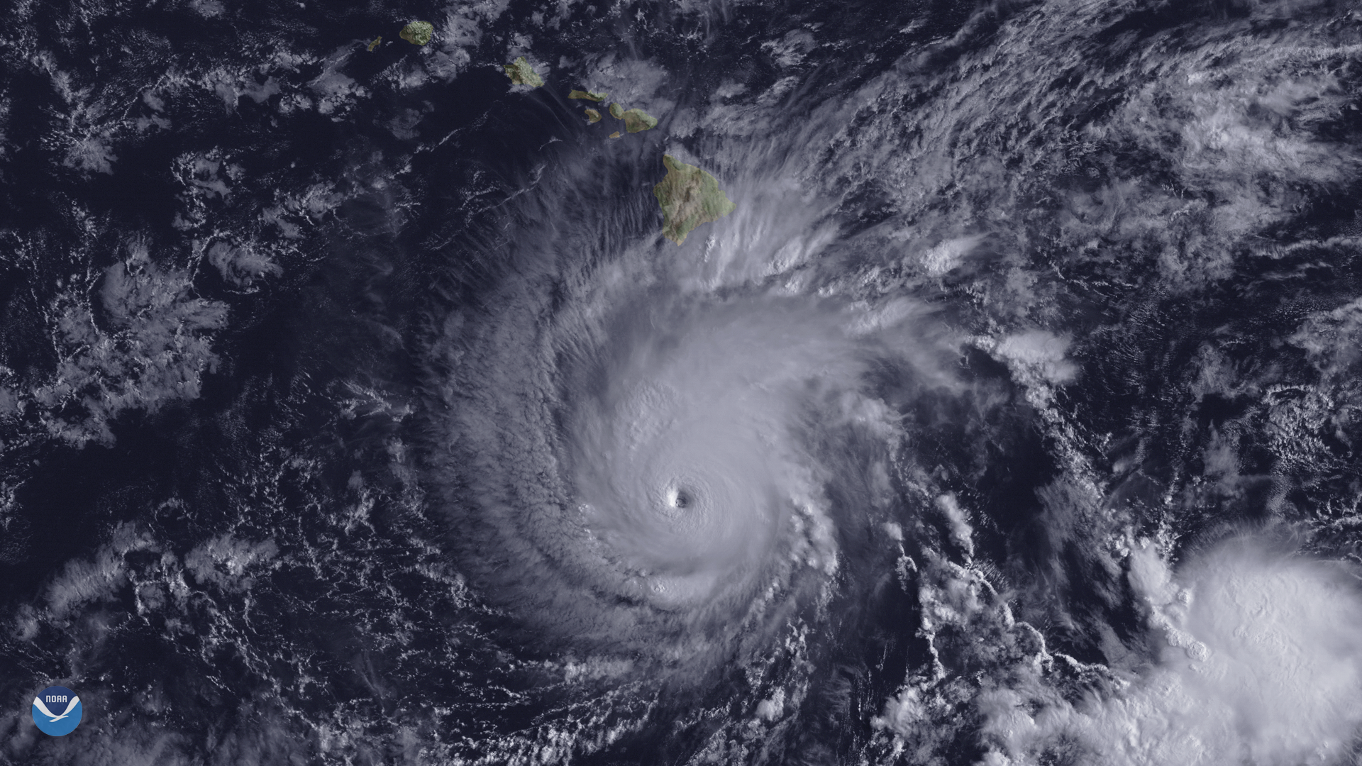
Hawaii is normally protected from approaching hurricanes because of cooler waters around the islands. An additional buffer is provided by a high pressure system that sits over the state during the majority of the hurricane season. Only two hurricanes have made landfall in Hawaii since the 50s. Hurricane Dot (1959) & Hurricane Iniki (1992). It has been a slow year in the Atlantic, but this year’s warmer than normal waters in the Pacific Ocean has fueled storms. Hurricane Lane, which briefly became a Category 5 hurricane on August 21st, is the 12th named Pacific Storm this year. The storm continued its track towards Hawaii with most forecasts predicting its path to skirt the islands before turning to the west. Lane weakened to a Category 3 on Thursday the 23rd but the outer bands of the hurricane began unleashing torrential rains over the islands. The Big Island recorded 8” of rain during these initial hours and landslides were already beginning to threaten homes and close roadways.
Hurricane Lane Current Conditions
Hurricane Lane continues to churn to the north, slowing its forward movement and dropping to a Category 2 today. The outer bands of the storm continue to bring downpours all over the islands with rainfall rates reaching 1 to 3 inches per hour. So far Hawaii’s Big Island has been the hardest hit, receiving 31 inches of rain as of this morning. Widespread flooding has inundated downtown Hilo and flash flood watches will remain in effect until at least Friday evening.
Evacuations have been issued for flood prone areas on the Big Island, Kauai, Molokai and Maui. There have also been reports of power outages and mudslides have closed several roads. Forecasters are confident the storm track will have the hurricane skirting the islands. Landfall, however, isn’t the biggest worry as the slow movement of the storm greatly increases the amount of rainfall that will impact the already water logged and slide prone slopes.
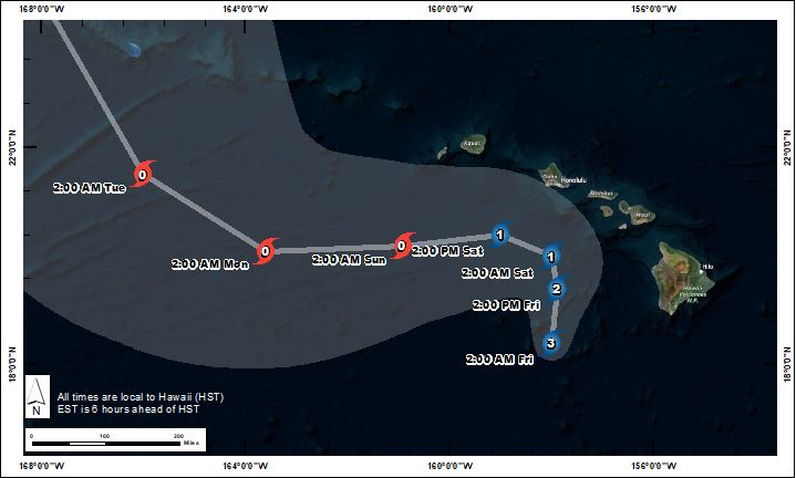
Current Forecast Track for Hurricane Lane
Ahead of the Rains High Winds Spread Brushfires
High winds associated with Hurricane Lane are also caused of a brushfire that ignited around 1am Friday morning near Lahaina, Maui. Fire fighters are currently battling the 300 plus acre fire which has prompted evacuations and already impacted numerous structures. Another fire near Kaanapali on Maui threatened homes and burned down a banana tree patch before being contained. Maui is expected to get over 8 inches of rain today which should help to extinguish the fires and allow fire fighters to gain containment, but the burn scars could exacerbate debris flows.
After its westward turn Lane is expected to lose strength, dropping to a tropical storm. The threat to Hawaii, however, will continue well into next week as the storm continue to drop heavy rainfall.