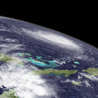
Tropical Storm Dorian is moving WNW over islands of the Caribbean, bringing winds and rain for Puerto Rico Dominican next. The storm is forecast to stay a Tropical Storm force over the next several days with the long term path over the Bahamas and towards Florida by the weekend.
Dorian’s Situation
Tropical Storm Dorian has passed over Martinique and St. Lucia on a WNW path into the Caribbean. Winds are sustained at 50mph but are forecast to increase to 60-70mph by tomorrow. Dorian has its sights set on Puerto Rico and the Eastern Dominican Republic the next two days with strong winds and heavy rainfall expected to accompany it. The worry is those areas are still recovering from 2017’s Hurricane Maria and lingering effects and impacts to power lines and other infrastructure. Unfortunately, recovery and monetary relief from the mainland due to that storm’s devastation remain ongoing issues. Although forecasters are keeping the intensity low as the storm approaches Florida for the weekend, much uncertainty remains in what may come following the storm’s DR passage, intensification-wise. We should know much more in both intensity and direction come Friday.
Storm Facts:
- Location: 60mi WNW of St. Lucia
- Max sustained wind: 50 mph
- Movement: NNW at 13 mph
- Storm Behavior: Rain and winds for Caribbean islands. Forecast to stay Tropical Storm force over the next several days with the long term path over the Bahamas and towards Florida by the weekend.
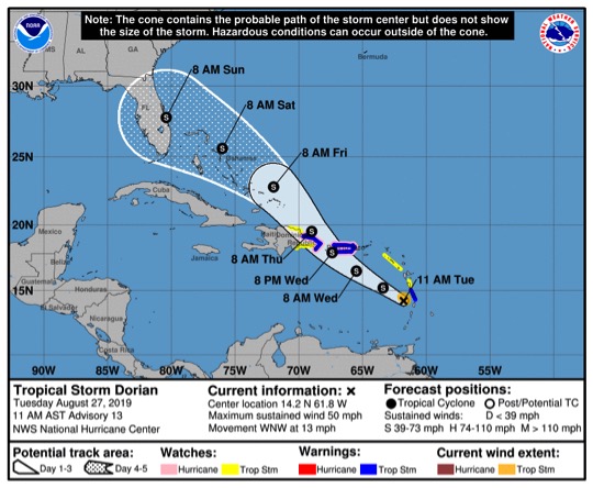
NOAA Five Day Storm Path for Tropical Storm Dorian
Sources: