Just as the Midwest United States is known as ‘Tornado Alley’ and earthquakes occur along fault lines more regularly than other locations, there are coastal areas at increased tsunami risk. As discussed previously, tsunamis are mostly caused by intense and sudden seafloor motion. While the first ideas to come to mind may be earthquakes and volcanoes (among others), the coastal areas most near these events are not necessarily the area(s) at highest risk.
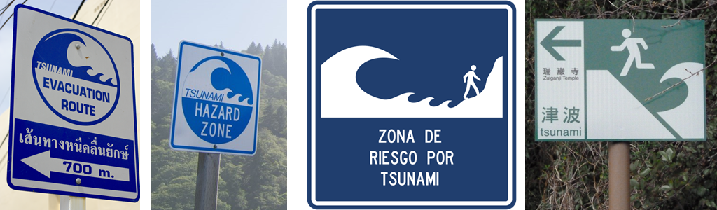
Tsunami evacuation signs from around the world, posted in areas of high tsunami risk (L to R: Thailand, California USA, Colombia, Japan; see end for credits)
Areas More Prone to Tsunami Risk
Many areas of tsunami high risk tend to be coastal regions around the Pacific Ocean: Chile and Peru, West Coast USA, Japan, and New Zealand. These are by no means the only places around the world a tsunami can hit; however, due to the numerous large and active plate boundaries, these areas are not a surprise to be on the list. Additional parts of the Earth more likely to be impacted by a tsunami are Newfoundland, Portugal, India, and much of the Mediterranean. Newfoundland, on Canada’s east coast, is probably a surprise to many, but its heightened risk factor is due to earthquake or volcanic activity across the Atlantic Ocean.
Historical Records
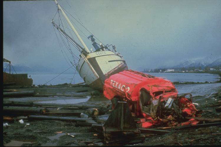
The National Weather Service keeps a calendar of historic tsunamis, their cause, the areas impacted, and the deaths and damages resulting from the event. The NWS notes even include events from as far back as 1820! As of December 2018, there are less than 40 significant tsunamis on record – ‘significant’ meaning the tsunami affected the U.S. states and territories and caused at least one death or $1 million in damage. The deadliest U.S. tsunami was recorded April 1st, 1946, triggered by an 8.6M earthquake and landslide near Unimak Island, Alaska, and not only impacted the full west coast, but also Hawaii and American Samoa. This incident sparked the creation of what is now known as the Pacific Tsunami Warning Center. The most destructive U.S. tsunami as relates to cost was recorded March 28th, 1964, from a 9.2M earthquake in southern Alaska and accompanying submarine landslides. The impact stretched down the west coast and out to Hawaii. This natural disaster spurred the creation of the National Tsunami Warning Center. What still remains the most expensive tsunami (and any natural disaster category) in the world originated March 11th, 2011, from a 9.1M earthquake near Honshu, Japan. While the impact to United States was low (1 death, $96 million), the worldwide total of destruction is a striking 18,434 deaths and $247 billion (both figures possibly including some count from initial earthquake).
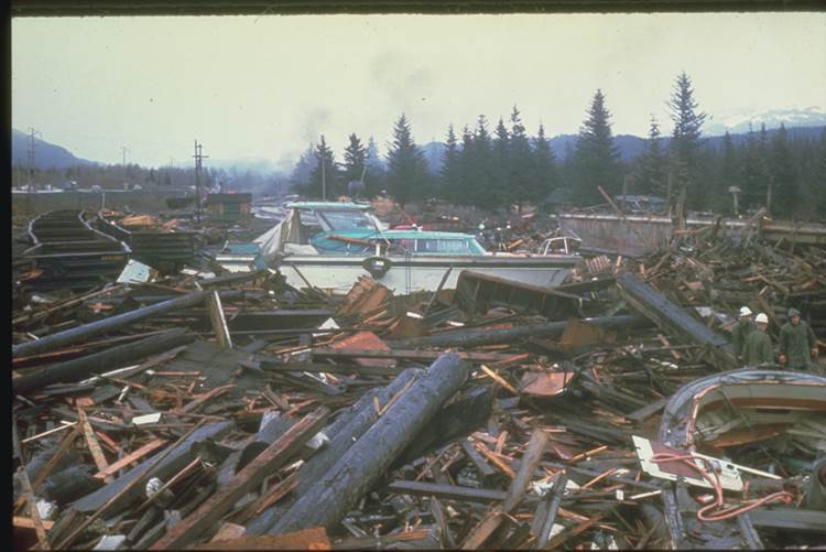
Tsunami damage to the north end of Resurrection Bay near Seward. The first wave arose after a waterfront and submarine slump developed within minutes of the beginning of the earthquake. A large mound of water rose in the fiord. This wave and other waves washed into the town of Seward destroying buildings, docks, railroad facilities, and small boats. About twenty minutes later the first wave from the major tsunami arrived. The maximum runup was between 30 and 38 feet (9.1 -11.5 m) above mean low water. Waves continued for more than eight hours after the quake. (Source: NOAA/NCEI, US DOI)
Read further:
U.S. Tsunami Hazard: https://nws.weather.gov/nthmp/ushazard.html
Worldwide Increased Tsunami Risk: https://www.yahoo.com/lifestyle/deadly-waves-which-places-are-most-at-risk-for-a-071704375.html
Tsunami Signs Sources:
Thailand: Alexander Klink – Own work, CC BY 4.0, https://commons.wikimedia.org/w/index.php?curid=45574738
California (Redwoods) USA: Henry Crawford (National Park Service) – https://www.nps.gov/articles/coastal-geohazards-tsunamis.htm
Colombia: Gobierno de Colombia, Manual de Señalización Vial – https://commons.wikimedia.org/wiki/File:Colombia_road_sign_SI-33.svg
Japan: Karl Baron – https://www.flickr.com/photos/kalleboo/4547816732
One Comment