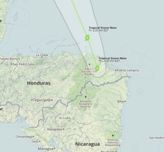
Tropical Storm Nate Facts:
- Location: Eastern coast of Honduras, 1,200 miles south of New Orleans
- Max sustained wind: 40 mph
- Movement: NNW at 10 mph
- Storm Behavior: Strong low pressure, heavy wind sheer forecasted to diminish leaving this storm the ability to intensify once it’s over water.
Tropical Storm Nate Overview:
Tropical Storm Nate is currently over the eastern coast of Honduras, dumping rain over Central America, with portions under a tropical storm warning or hurricane watch. Over the next few days the storm will move north towards the eastern edges of the Yucatan Peninsula and into the warm waters of the Gulf of Mexico. The troubling thing about this system is, as the storm moves north and into the Gulf, it is likely to intensify. Nate is currently displaying winds ranging from 39-73 mph, once this storm reaches the Gulf of Mexico it is forecasted to increase its wind speeds to 74-100 mph and become a category 1 hurricane.
According to the Weather Channel, portions of Central America could see up to 18 inches of rain through Friday as this system passes through. This amount of rainfall is already triggering flash floods, and mudslides throughout the area. These flooding events have already claimed 17 lives across Central America. As you can see in our map and the NHC map below, Nate is forecast to reach the northern Gulf Coast this weekend above tropical storm force. The NHC is warning of the threat of direct impacts from wind, storm surge, and heavy rainfall is increasing from Louisiana through the Florida Panhandle. Experts are expecting a hurricane watch and storm surge watch to be issued for coastal areas of the northern Gulf Coast as early as tonight or Friday morning. The path of the storm seems more certain than other storms this summer as the majority of hurricane models are in alignment on the direction and timing of the storm.
Additional Info:
NHC NOAA Tropical Storm Nate Page
Tropical Storm Nate Forecast Advisory
Tropical Storm Nate Forecast Discussion
Map:
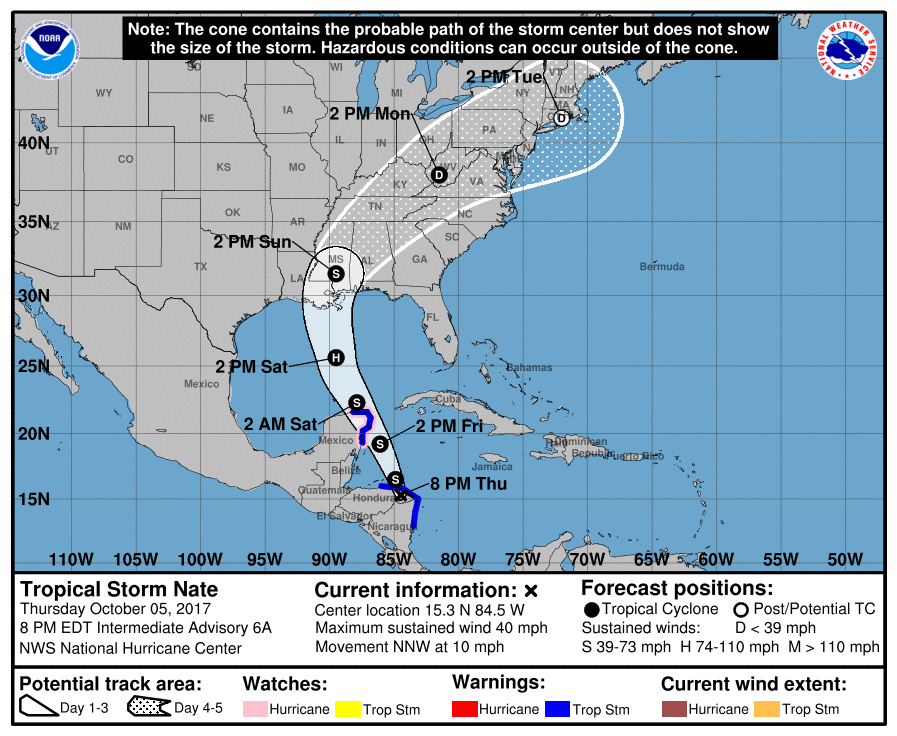
NOAA Potential Track Map issued Thursday Oct 10th, 8pm eastern
Sources: NOAA, The Weather Channel, National Hurricane Center, National Weather Service