The Central Coast of California has been a hot spot for activity this year. The normally quaint and quiet Big Sur area is one of the wettest and most rugged in all of Coastal California. In the past year, the area has seen the region’s largest ever fire (Soberanes), and its highest winter rainfall accumulation in over a decade. Although the latest winter storms in February have pulled the area out of a six year long drought, it also has also–quite literally–split the Monterey County community in two.
Heavy Rains Damage Monterey County Roads and Bridges
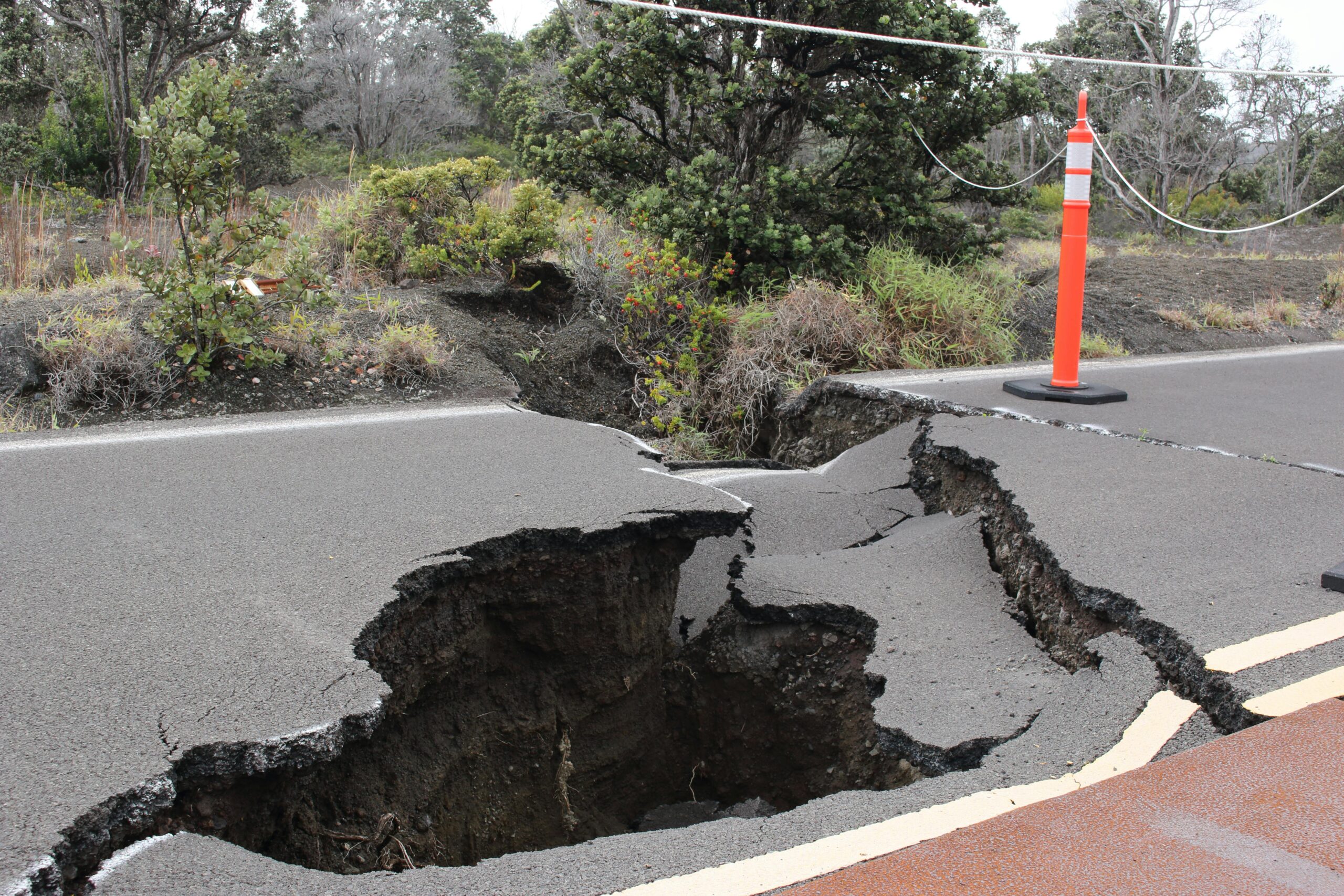
Since the beginning of the year, the well-traveled section of Highway 1 through Big Sur has seen over 15 inches of rain, and its steep hillsides have endured numerous land and mud slides. Consequently, a 50-mile stretch of the highway has been closed to facilitate a major cleanup effort for the better part of a month. What’s worse is that the Pfeiffer Canyon Bridge (in the Soberanes Fire area) has actually buckled due to the support columns moving from heavy runoff during early February’s rain events. Highway 1 has had a hard closure there, making the highway impassible since February 12th.

The Pfeiffer Bridge in Big Sur has been impassible since February 12, 2017
As a result, tourists have had to deal with very long detours and local residents have been left stranded. The bridge’s support columns have shifted a significant distance from their operational location and have made the bridge unable to support the minimum mandated weight. Cal trans crews are working on plans to demolish the bridge into 3 manageable sections for removal and then begin the yearlong process of building a new structure. Crews have spent the weeks since the bridge damage discovery moving demolition equipment into place using helicopters.
On March 13th, the demolition process began with a 6,000 pound wrecking ball. After a few hours of work the crews realized that in the current configuration, the wrecking ball could not get enough downward force to break up the bridge. Parts were ordered to change the configuration and demolition personnel were set to try again on March 15th.
Impact to Big Sur Residents Could Last Months
While the road crews focus all their efforts on getting more sections of the Highway open, around 400 residents have been unable to drive from their homes, relying only on their supplies at home. Due to the lengthy closure, affected homeowners have run low on food and water. Some are resorting to travelling by foot to get hundreds of pounds of food while others are utilizing rations that have been flown into locations by helicopter.
A plan is underway to actually build a new hiking trail (1/2 mile foot path) that can be used by homeowners to get around the Pfeiffer Bridge closure. The trail is being constructed by California Conservation Crews and numerous volunteers, and will take some time to complete. The use of the trail will be limited to residents and can only be used during specific hours.
For emergency responders, the closure situation causes a different problem in terms accessing residences during future emergency situations. The new bridge will take months to construct and the Big Sur Volunteer Fire Brigade is responsible for the safety of residents on both sides of the closure. As a solution, the brigade has actually split into two response areas but, at this point, cannot access all of their response territory. Currently, there is a contingency plan in place to use a Medivac helicopter to get people out that may need medical attention. The Big Sur Medical Center, which is also affected by the closure, has continued to receive medical resupply, including daily prescriptions that area residents need. The sense is that local authorities seem confident in the contingency plan in place. They have said numerous times that they will be able to provide emergency services to all remote areas.