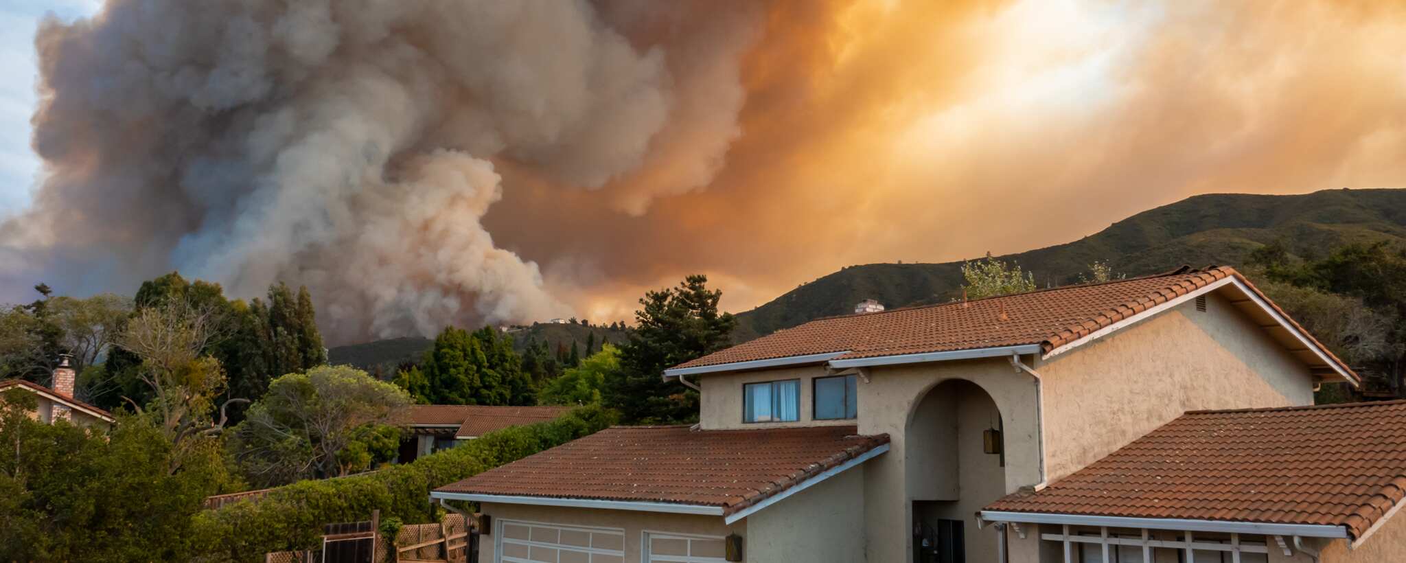
Wildfires can be devastating and dangerous, causing significant damage to property, wildlife, and even human lives. Effective communication and coordination are critical in responding to these emergencies. With the advent of technology, new tools have become available to assist in these efforts, one of which is the “What3Words” application.
What is What3Words?
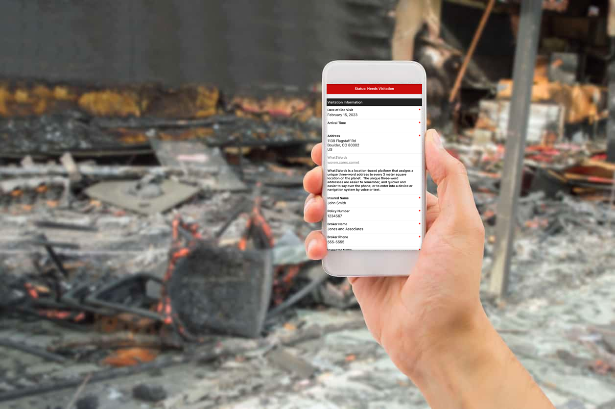
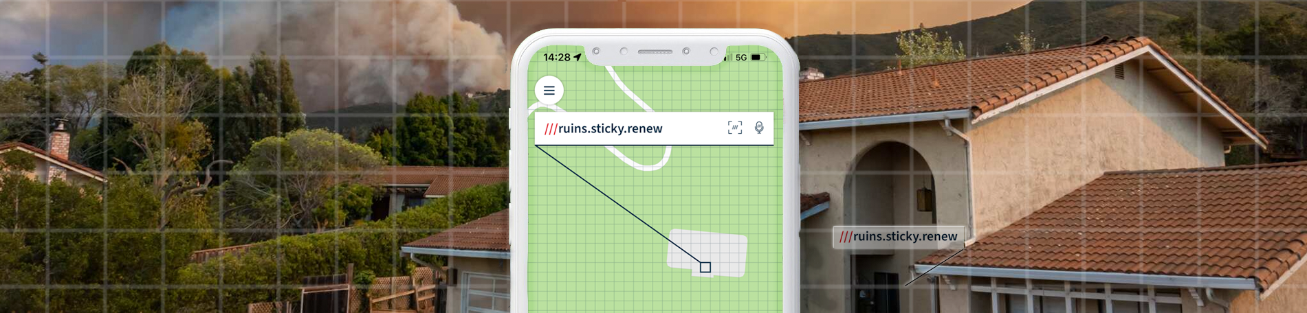
What3Words is a location-based platform that assigns a unique three-word address to every 3-meter square location on the planet. The platform makes it easier for individuals to communicate and remember a location. Additionally, the application has the potential to revolutionize the way that firefighters respond to and fight wildfires.
“By using What3Words, first responders can quickly and easily identify the exact location of an emergency, without the need for addresses, or difficult-to-remember latitude/longitude coordinates. What3words addresses are a human-friendly way of giving the same information as 16-digit GPS coordinates:
51.520847, -0.19552100 ←→ /// filled.count.soap
They are easier to remember, and quicker and easier to say over the phone, or to enter into a device or navigation system by voice or text. What3Words has error-prevention technology which helps users quickly identify and correct input mistakes.”
Over 80% of UK emergency services accepted the program. In addition, the platform is currently used in over 139 different countries. Recently, after a successful pilot program, the Dallas Police Department and Dallas Fire Rescue adopted the use of the what3words.
Benefits to Wildfire Response
Wildfire outbreaks can occur in remote and rural areas where traditional street addresses may not be available or easily accessible. The ability to accurately and quickly communicate the location of a fire enables a faster response time and potentially saves lives and property. After the fire moves through, physical address markers and street signs have often been damaged or destroyed. The 3-word location of these structures can be communicated to firefighters or damage inspection teams. They can then navigate to the property using conventional GPS or navigation apps, or even use the applications compass feature if no signal is available.
These unique 3-word addresses can also share the location of evacuation centers, safety zones, and water sources. Additionally, the addresses can identify the exact location of specific hazards. For example, firefighters can quickly and easily communicate the location of “widow maker trees”, enabling the trees to be flagged or the area to be avoided due to safety concerns.
More real-life examples of the tech in action in North America can be found here.
What3Words and Redzone
Redzone has begun exploring the integration of What3Words into client-facing dashboards, RZRisk reports, property consultations, and incident response reports. Partner companies, such as Fulcrum, have adopted the use of What3Words and opened up the opportunity for developing more tools through their API. The ability to quickly and easily communicate the exact location of a structure, without the need for addresses, or difficult-to-remember latitude/longitude coordinates would be extremely valuable to field mitigation teams, underwriters, and the RZ Intel Team. Policyholders could be educated on the service and provided their unique 3-word addresses through mitigation consults and risk reports. Most importantly, they will be able to quickly share their location in case of emergencies.