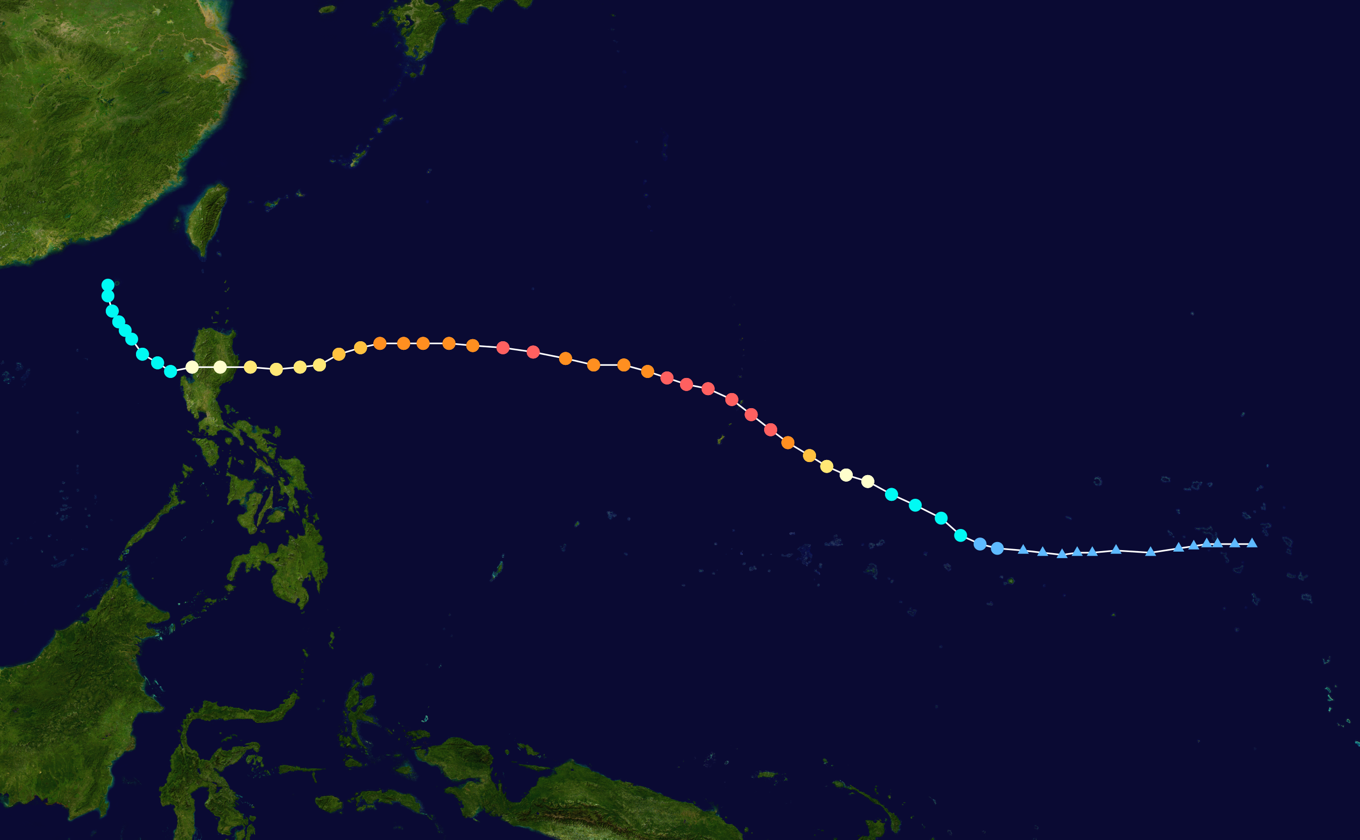
On October 21st, 2018, Typhoon Yutu began its development as a tropical depression, east of the Northern Mariana Islands, a US commonwealth. Just hours later, the storm reached tropical storm strength over the warm waters of the Pacific Ocean. During the period of the next three days Yutu would intensify to a Category 5 Typhoon. Around 2:00 AM on October 25th, Yutu made landfall on the Northern Mariana Islands. Satellite imagery shows the eye of the storm passing directly over the island Tinian (population 3,136), completely encompassing it as the devastation within the eye-wall continued on the surrounding islands of Saipan (population 52,263), Rota (population 2,477), and Guam. The damage received during the typhoon’s arrival would leave the island communities nearly unrecognizable. Yutu would be recorded as the strongest storm to impact a US territory in 2018, and the strongest to impact the Northern Mariana Islands in recorded history.
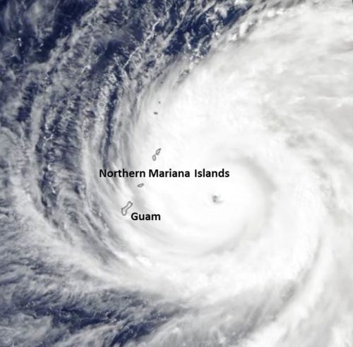
This image depicts the Northern Mariana Island chain’s location in the midst of Typhoon Yutu.
Super Typhoon Yutu’s Conditions Upon Landfall in the Northern Mariana Islands
Sustained Winds: Sustained 180 mph, Gusting over 200 mph
Storm Surge: Up to 20 feet
Rainfall: Up to 10 inches
The tone of the statements released by officials leading up to the storms arrival was indicative of the damages that would be seen in the days prior to Yutu’s landfall. The National Weather Service office in Guam released this frightening message before the storms arrival, “Most homes will sustain severe damage, with potential for complete roof failure and wall collapse. Most industrial buildings will be destroyed.” These comments proved to be unnervingly valid once the storm had passed.
After the preliminary aerial damage assessments were completed on October 29th, the figures shown below give insight to just how severe the damages are.
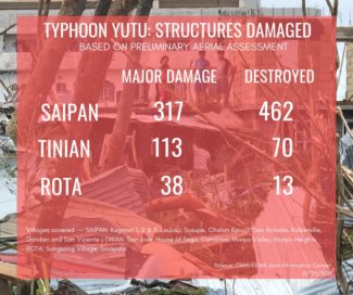
This figure shows the results of the preliminary damage inspections. Officials conducted these inspections during the first fly over after the storm had passed.
These aerial images released by DigitalGlobe give further testament to the absolute devastation that occurred in the disaster area.
It is estimated that these communities will be without power for months in the wake of Typhoon Yutu. Saipan currently has 99 percent of its community without power, Tinian is 100 percent out of power, and the small island of Rota has restored power to 99 percent of the island.
In the 96 hours after the storm’s passing, 121 storm related emergency room visits were recorded. Unfortunately two lives have been lost from this community during this natural disaster.
Yutu continued on its path of destruction after it passed over the Mariana Islands, its next stop, the Philippines. Even though the storm’s intensity, in terms of wind speeds was not as great in this impact area, the devastation was still staggering. With the Philippines already saturated with moisture from the Typhoon Mangkhut, the unwelcomed rainfall from Yutu exacerbated the troubles for locals in the mountainous areas of the Philippines. As the storm hit, the rainfall caused massive landslides throughout the countryside. Roads throughout the impact area have been blocked by debris making recovery efforts difficult for the first responders. As the recovery process is continues, it truly paints the picture of how bad these events really are for these communities.
Read further:
https://www.cbc.ca/news/world/super-typhoon-yutu-destruction-1.4879117
https://www.cbc.ca/news/world/typhoon-yutu-philippines-1.4883540
https://earthobservatory.nasa.gov/images/144137/super-typhoon-yutu