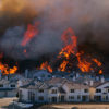
The West Coast is bracing for yet another heavy rain event. Luckily, each storm this winter has slowly helped the previously dire drought situation, which covered most of the State of California. This storm, however, will bring sustained rain from Southern Oregon all the way south through San Diego. The worst of it, though, has its sights set on Southern California, arriving late Thursday. Meteorologists are predicting the region may see the heaviest precipitation in six years, including up to 8 inches in some areas. The National Weather Service in Los Angeles is saying that daily rain records are likely to be set on Friday. Strong winds, up to 50 or 60 mph, are also expected. As the heavy rain nears, local authorities are preparing for widespread road closures, power outages, tree damage, flash flooding, and coastal flooding.
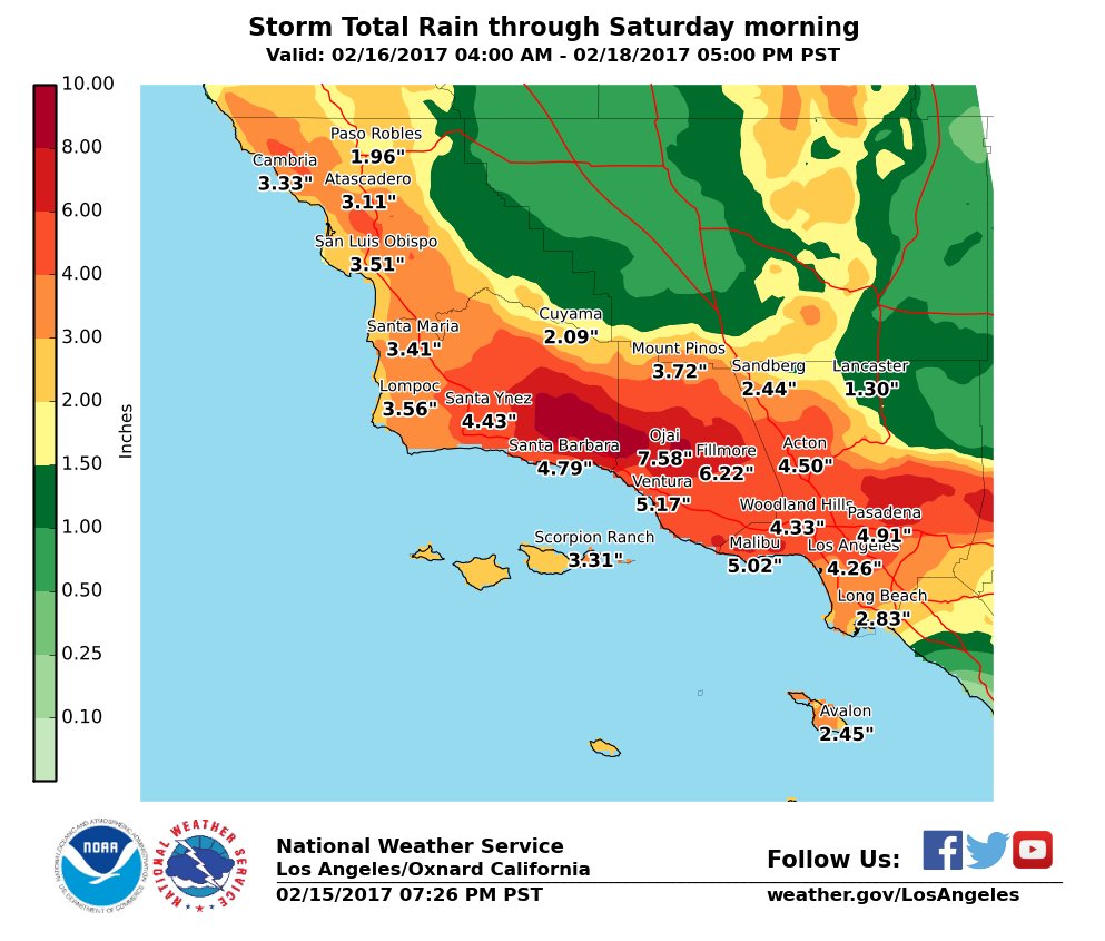
Projected Rainfall for the next 36 hours from the National Weather Service out of Los Angeles
Mudslide Potential
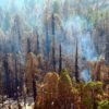
There will also be a real potential for mudslides in some areas, especially within the several recent burn scars in the region that align with the heavy expected rain (seen in the map below). Approximately 180 homes in Duarte have already been evacuated ahead of the storm due to their close proximity to an expected debris flow from the Fish Fire burn scar. Similarly, residents in Glendora, near the Colby Fire burn area, were told to remain “on alert”. Local officials are likely being cautious as annually the CDC reports 25-50 deaths a year from mudslides on average in the US.
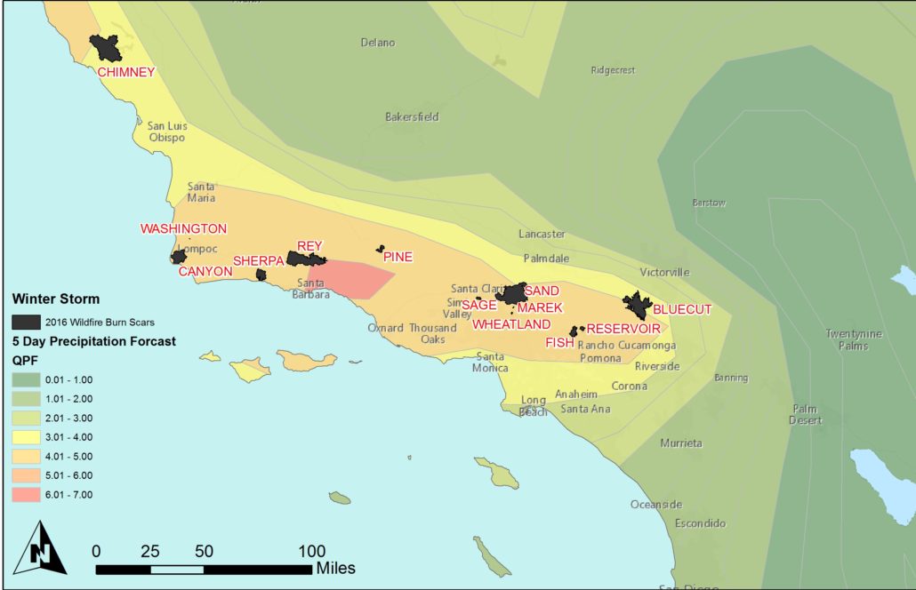
Map showing where 2016’s recent burn scars shown against the forecasted rain totals for Southern CA
Northern California to See Heavy Rain Too
While Northern California will not see as widespread a downpour, that region will also see significant rainfall totals. Due to the incoming storm, the Lake Oroville situation remains troubling, despite the fact that Butte County Officials have technically lifted the evacuation orders for residents. The lake has lowered 30 feet since its peak during the last storm. Officials hope they can relieve the reservoir of another 30 before the rains arrive again (the current rate is reportedly one foot every three hours). Unfortunately, the Oroville watershed is forecast to receive another 5-8 inches of rain itself by the end of the weekend, which could swell the lake to complicated levels again. Fortunately, the rain has continued to help swell California’s reservoirs statewide to near or, in most cases, over their historical average level.
Additionally, heavy snow is also projected for the high elevations and Sierra Nevada Range. An additional two feet of snow is forecast to add to the already above-average snowpack throughout the region. As an example, Eastern Sierra’s Mammoth Mountain, which has already received a whopping 432 inches of snow this winter, is expecting another 24-32” by Wednesday night.
Sources
National Weather Service, The Weather Channel, AccuWeather, LA Times, NOAA