Tropical Storm Hermine Current Situation (as of 1800 UTC, Sep 2nd, 2016)
- Location: 30 miles WSW of Savannah, GA
- Category: Tropical Storm
- Maximum Sustained Winds: 50 mph
- Present Movement: NE at 18 mph
- Minimum Central Pressure: 993 mb
- Impact: Several areas reporting damage and flooding, along with power outages
- Incident Page: NHC Public Advisory
- News Article: WunderBlog
Tropical Storm Hermine Impact
Tropical Storm Hermine (pronounced her-MEEN) traveled thousands of miles as a relatively insignificant storm off Western Africa before it strengthened in the Caribbean and made landfall as a Category 1 hurricane. St. Marks, Florida saw the eye meet land around 0140 EDT on the morning of September 2nd, marking Florida’s first hurricane to run aground in eleven years.
By 0500 EDT, as the storm had traveled north into Georgia (where it currently still sits), and weakened to tropical storm-force winds. In its wake, the storm caused major coastal damage in Taylor County, FL as well as widespread damages from strong winds, downed trees, heavy rain, and flooding across GA, FL, and SC. Consequently, power was lost for an estimated 250,000 residents in Florida, including 80% of the capital city of Tallahassee. As of midday on September 2nd, Hermine was heading for North and South Carolina with sustained winds 50 mph.
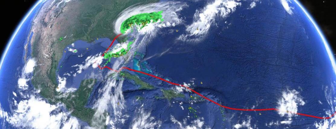
Hermine’s path through the Atlantic and Current Satellite Imagery
Hermine Weakens Only to Strengthen Again?
Although the storm will slowly weaken over land and should become a post-tropical cyclone, uncertainty remains for what the storm will do when it returns to the waters of the Atlantic. There remains a possibility that the system could regain some tropical characteristics within four to five days and strengthen again. Subsequently, future impacts are difficult to predict, and forecast models are wide-ranging.
Where Will It Go?
With 10+ inches of rain and strong winds forecasted, residents in the Jacksonville, Florida area and further up the coast are bracing for an impact of their own. The storm has officials concerned all the way into the northeastern part of the country as the cone of uncertainty begins to broaden. Predictions of the storm’s path through the Labor Day weekend become murky, and indicate a potential for damage over a wide area. The National Hurricane Center is predicting heavy rainfall to reach the coastal areas of Delaware and New Jersey by Saturday Night with storm surge and coastal flooding potentially stretching from Virginia to Connecticut.
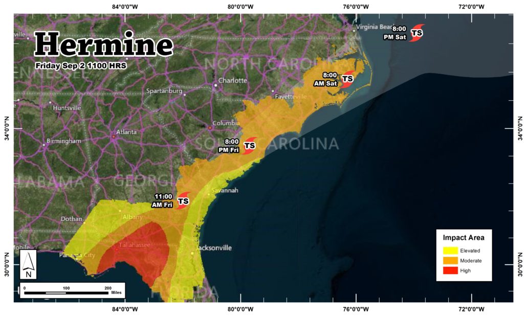
Hermine’s impact area and projected path through Saturday Evening
Sources: National Hurricane Center, Weather Underground, The Weather Channel
[/av_textblock]