The Fort McMurray Fire has destroyed tens of thousands of acres and hundreds of structures since it ignited early Monday (May 2). Fueled by extreme fire weather and dry conditions, the wildfire has completely decimated the Fort McMurray area in Northern Alberta. Multiple videos have surfaced online as 80,000 evacuated residents scrambled to get out of the way of the flames when it ripped into the city and destroyed whole neighborhoods. NASA fire detection satellites mapping the fire show it starting west of Fort McMurray, growing steadily northeast into town all day Tuesday (May 3) and into Wednesday (May 4) morning. An even bigger push started Wednesday night into Thursday (May 5) as the fire barreled to the south and east, backed by 70km/h winds and grew from 10,000 hectares (ha) to around 85,000 ha. Damage estimates today (May 6) include another 12 structures involved in the Anzac area on top of the estimated 1,600 structures lost in Fort McMurray earlier in the week. So far 88,000 people have been evacuated. The fire’s size is now (May 6) estimated at 85,000 hectares (210,000 acres), it’s continuing to move to the southeast with multiple fingers and spot fires, and with no signs of stopping.
The weather isn’t expected to provide much help in fighting the fire, with only slight cooling this weekend following this week’s lack of rain and record hot temperatures. “Another period of hot and mostly dry weather is forecast for the region this weekend as another ridge builds over Western Canada,” warns Weather Network meteorologist Brett Soderholm. “Widespread rainfall across the region is looking unlikely during the next week.”
For more information on the McMurray Fire visit : Fort McMurray Wildfire from Global News
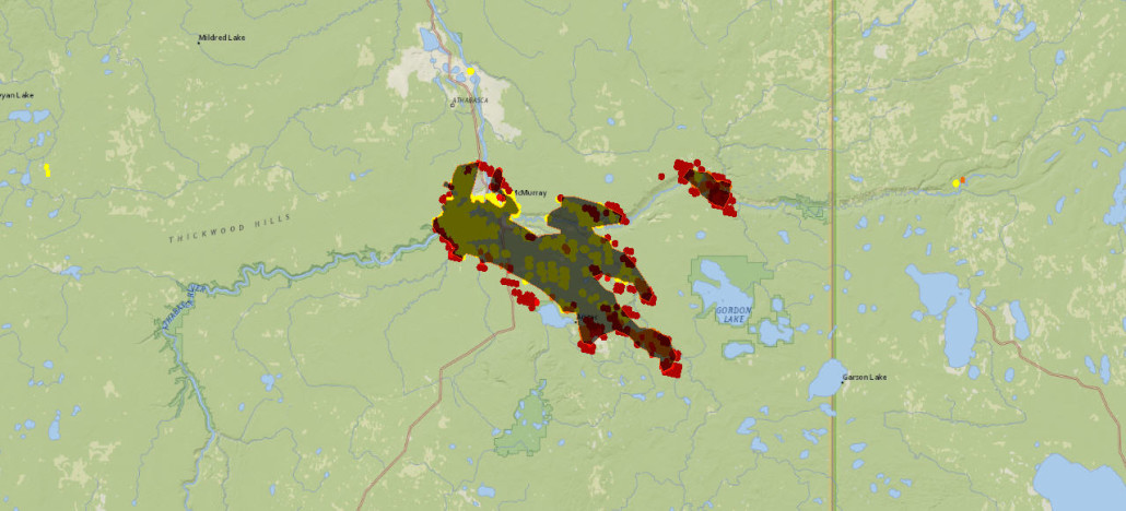
Estimation of Fort McMurray Fire Perimeter (as of May 6th) with Fire Detection points visible


One Comment